RESOURCE MANAGEMENT COMMITTEE

A valley wide forestry committee was put together in the spring of 2014 to advocate at a “big picture” level on issues of concern for the entire
valley. In 2017 the scope and mandate was change to more generally reflect land use and resource management issues. We expect areas of interest to include logging, mineral exploration and all forms of land use.
The committee consists of representatives of the Gun Lake, Marshall Lake and Tyaughton Lake Ratepayers Assn. as well as the Trails Committee (BRVCA) and the Bralorne Community Advisory Committee (BRVCA).
In addition community members from the Yalakom have joined in and we have gone to the Yalakom to support each other on forestry issues.
Terms of Reference for the Committee
Forestry in the Bridge River Valley
Below you will see a great deal of different kinds of information and maps related to forestry in the upper Bridge River Valley. Click on the links below for more information. Scroll down to leave a comment.
Click on the links below to find documents & maps specific for each neighbourhood. More information will be added as it comes in.
Lillooet harvesting companies have timber licenses in the valley and logging is actively happening in and around our neighbourhoods.
* Salvage Logging Downton Lake Fire
* Salvage Logging Images
* Post Wildfire Disturbance Literature
* Gun Lake Logging
* Marshall/Liza Lake Logging
* Tyaughton Lake Logging
* Bralorne Logging
* General Logging Information
SALVAGE LOGGING 2025 UPDATES
It’s been quiet on the logging front all summer and the plans for fall/winter 2025 harvesting on the slopes in the burn above the North West end of Gun Lake is going ahead.
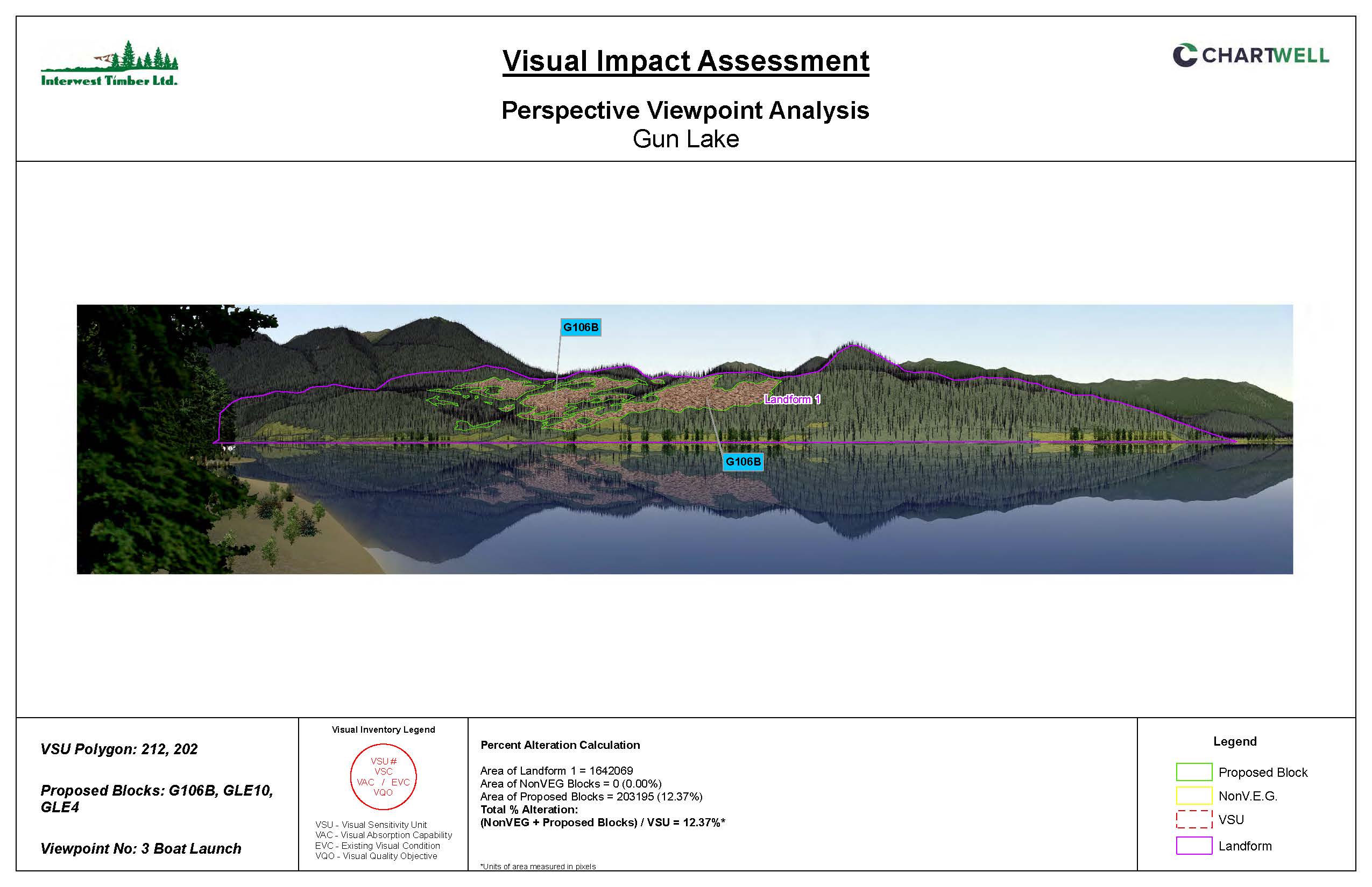
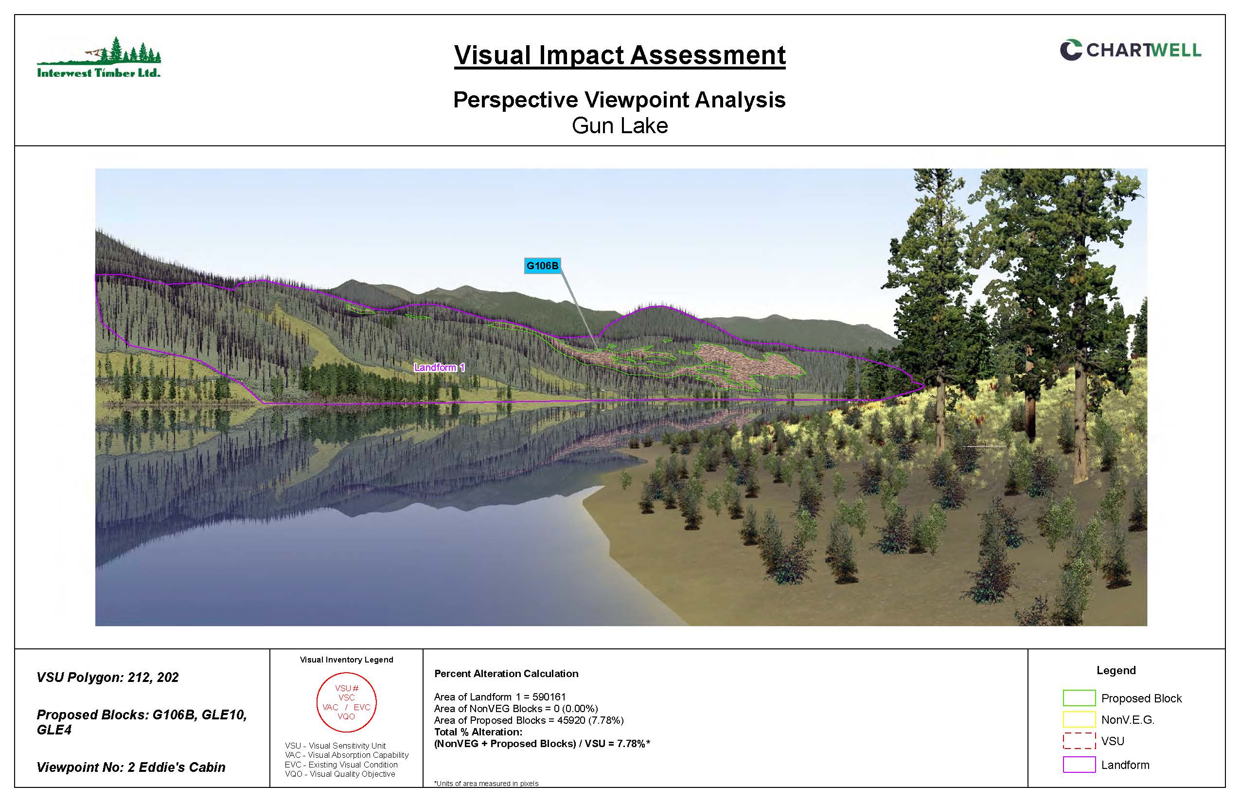
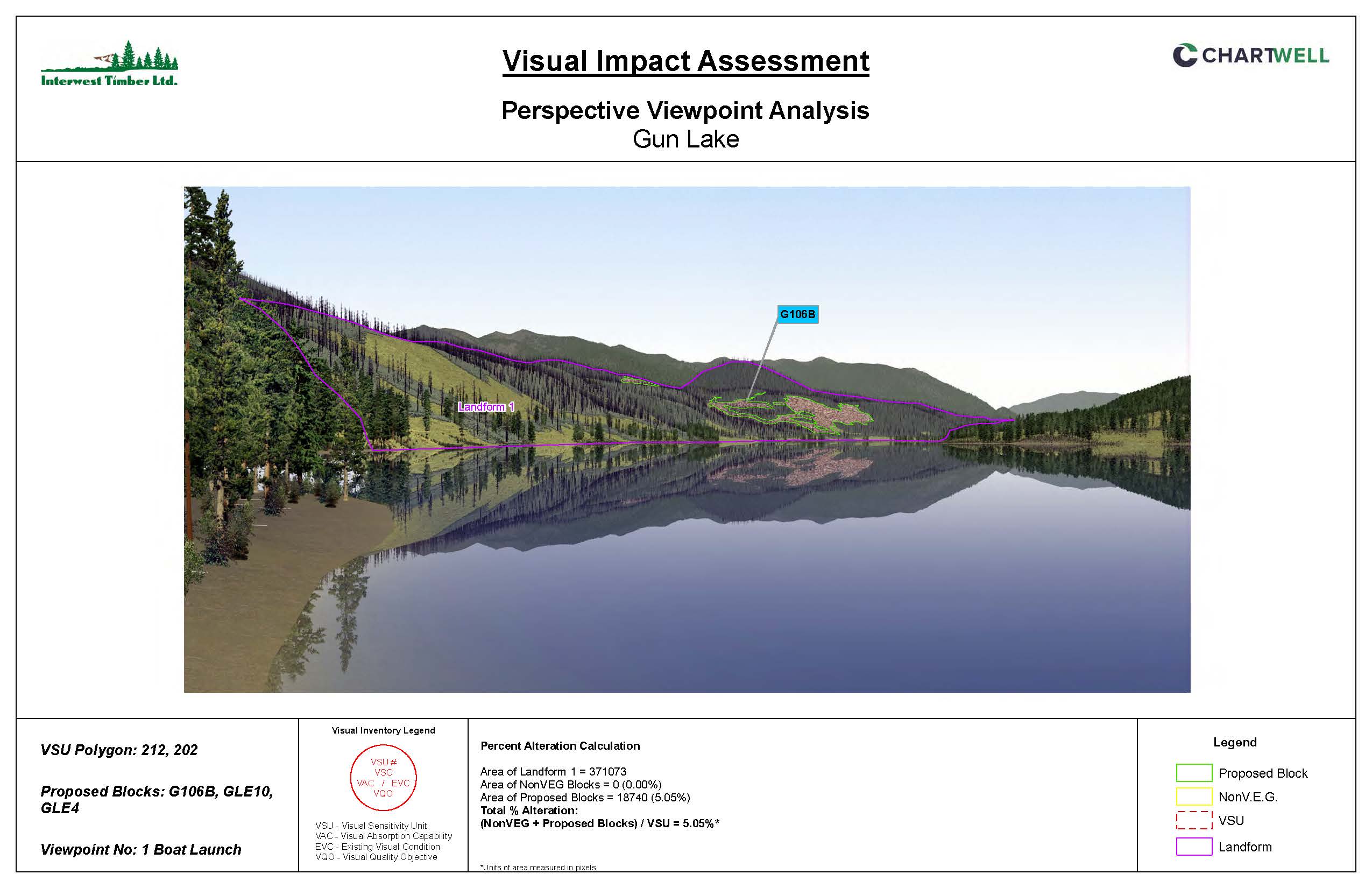
Interwest have sent out the hydrology report completed in 2024 post fire and before the regrowth occured, a terrain study from Octo Engineering completed in July 2025 and visual impact assessments from 3 locations around Gun Lake. These 3 images are displayed below. To get a feeling of how this cutblock will be viewed from your property, take a look at the map and the locations of the visual impact sites.
Click the link below for more detailed information. The overview map received was incorrect and the new overview map and detailed maps of each cut block have now been added to the folder below.
Click here for links to the most recent doucmentation received from Interwest
A public meeting may be held next Tuesday September 24. More details will be available soon.
The latest mapping shows the original planned size of the cutblocks have been reduced. Images below show the original cutblocks on top and the final cutblocks below.
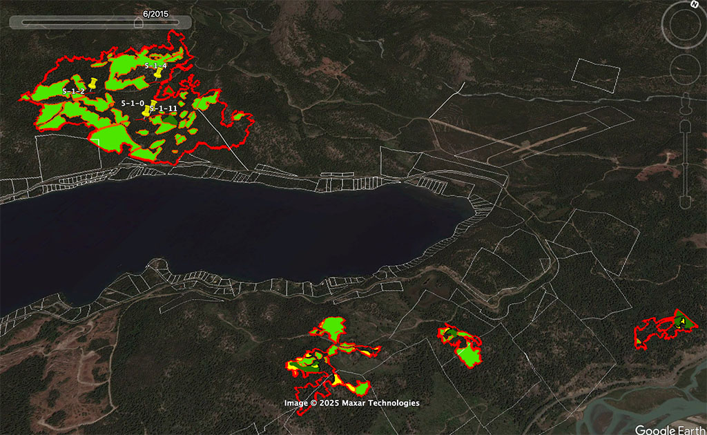
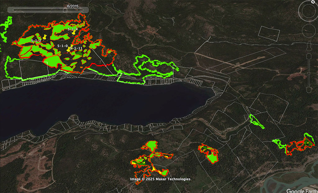
PLANNED SALVAGE LOGGING 2024 Updates
A meeting was held with Interwest on July 17 and that meeting can be watched by clicking here.
A lot of good questions were asked in the chat and Interwest will respond to the written questions. Questions to answers from the July 2024 meeting were answered in January 2025 and can be read here.
Residents have been submitting images of the logging as it happens can be seen here.
Thease are the planned Cutting Permits:
CP004 – orange blocks – completed
CP005 – purple blocks – to be completed starting November 25, 2024. The latest mapping for CP005 can be seen here
CP007 – green blocks in high risk for landslide areas. Mapping for CP007 can be seen here
CP007 – Feb 7 Update: CP007 has been split up to do the north end of the lake first. New Mapping can be seen here:
CP008 – red blocks
Overview of the new CP-007 in the green shapes on the map below.
CP-004 – Orange. Completed.
CP-005 – Purple. In progress.
CP-008 – Red.

The map below shows the salvage blocks as well as all the logging blocks from the 20 year historical files.




0 Comments